Traffic Management Dashboard
City of Syracuse - Syracuse, NY
Markets utiltized:
Keywords
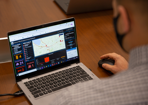
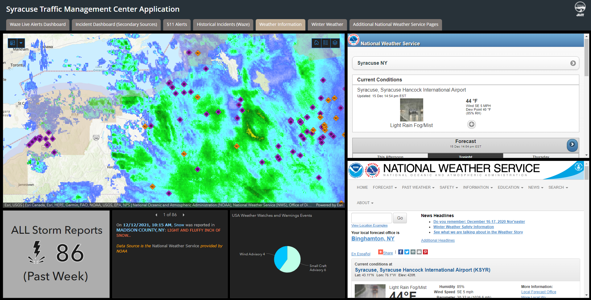
Traffic management centers (TMC) allow for decision making and control for a region’s street and highway network with TMC operator decisions affecting a region’s traffic signals, intersections, roads, congestion, reliability, as well as incident response during special events, emergencies, and crashes. The Syracuse TMC identified the need for a tool that could incorporate multiple data sources into one interface to improve situational awareness and make better data-informed decisions. To meet this need, JMT developed a web-based transportation dashboard for the TMC inside of the city's ArcGIS Online environment. A significant part of the effort involved identifying and evaluating the various data sources for inclusion in the pilot dashboard including near real-time data.
After the successful deployment of the Phase 1 dashboard, the TMC desired to enhance their operational awareness by integrating real-time bus data from the regional transit agency. JMT utilized ESRI’s ArcGIS Velocity to create dynamic feature classes from the raw data feeds via the Application Programming Interface (API) provided by the third-party vendor. The API provided access to transit information important to TMC operators like current bus location, heading, date/time, route information, stops, delay status, and service bulletins.
In addition, JMT used Arcade expressions for custom symbology of the bus data within the web map, Arcade expressions for date/timestamp reformatting of the bus data, and instituted geofencing around the bus operations and maintenance facility to effectively hide buses that were not in operation.